A Beautiful Day in the Neighborhood

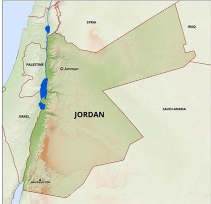
Well, it’s a beautiful day in some neighborhoods. Jordan lives in a rough part of town. Her neighbors are Syria, Iraq, Saudi Arabia, and Israel. Lots of stuff going on in those houses.
They all need a Mr. Rogers to make their lives kinder and gentler, wouldn’t you agree?
Actually, Jordanians are kind and gentle, as I have observed first hand. Their country is sometimes referred to as “the Switzerland of the Middle East” or the liver (purifier) of the Arab body. Jordan is the most moderate of all Arab countries. It’s the neighbors who are obstreperous.
I give Israel a pass because it must defend itself against the previously-mentioned residents.
Living in a country that is slightly smaller than Indiana, Jordanians enjoy not only a kind, gentle atmosphere but stunning geography.
And that is the subject of today’s blog: The geography of Jordan.
Climate
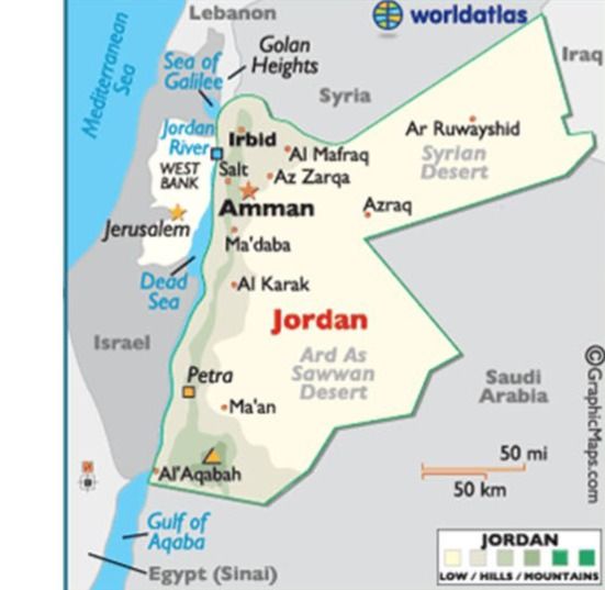
When you think of Jordan, you probably think hot, dry desert, right? That’s partially correct. It is mostly an arid desert. The eastern part is desert plateau. In the west are the highlands. And the 108-mile-long Jordan Valley, which it shares with Israel, separates the east and west banks of the Jordan River. It runs from the Sea of Galilee to the Dead Sea, where the river ends. The Great Rift Valley continues on to Aqaba and farther south.[1]
This is a small part of the Great Rift Valley which begins in the Beqaa Valley in Lebanon and runs about 3,700 miles to Mozambique, Africa. It is not one long trench but related rift and fault systems. It is one reason the countries through which it runs have so many earthquakes.[2]
In the south, where Aqaba is nestled between the mountains and gulf, the rainy season tempers the extreme heat from November through April.[3] Our Aqaban friends, the Ryans, say there are two seasons: autumn and summer. We were in Jordan last November and December, and the 80° days were such a delight.
Mountains
The most significant mountain range runs east and southeast of the Dead Sea. It is called the Abarim Mountains. Abarim means “regions beyond or crossings ” and comes from a root word eber from which we get the word “Hebrew”.
Abraham was the first Hebrew because he crossed over to the land of Canaan from Ur of Chaldea, and he also crossed over from a family of idol makers to worshiping the one true God.
It was mentioned in Scripture as one of the places where Israel camped near the end of their forty-year sojourn:
And they removed from Almondiblathaim, and pitched in the mountains of Abarim, before Nebo. And they departed from the mountains of Abarim and pitched in the plains of Moab by Jordan near Jericho. Numbers 33:47-48 KJV

Mt. Haroun, in the same mountain range, is where you can visit Aaron’s tomb today. At 2,680 feet, Mt. Nebo is the highest one in the range. It was Moses’ final stop.
And [Yehovah] said unto Moses, “Get thee up into this mount Abarim [range], and see the land which I have given unto the children of Israel. And when thou hast seen it, thou also shalt be gathered unto thy people, as Aaron thy brother was gathered.” Numbers 27:12-13 KJV
It was reiterated in Deuteronomy.
And the LORD spake unto Moses that selfsame day, saying, “Get thee up into this mountain [range] Abarim, unto mount Nebo, which is in the land of Moab, that is over against Jericho; and behold the land of Canaan, which I give unto the children of Israel for a possession:…” Deuteronomy 32:48-49 KJV
From here the tribes descended westward to the Plains of Moab on the east side of the Jordan River and the northeast end of the Dead Sea. It was in this area where Sodom and Gomorrah were situated at the caravan crossroads of the world before their destruction. This was Israel’s final encampment before entering the Promised Land.
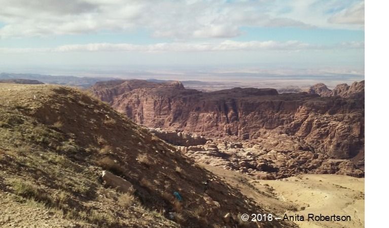
Petra is also located in this range. Later, I will dedicate an entire blog to it, so I won’t elaborate here.
Amman Citadel
The highest of seven hills in the capital city of Amman, Jebal Al-Qal’a (meaning Castle Mountain, also called Amman Citadel) is an L-shaped hill overlooking downtown. The town was originally built on these hills and was known as Rabbath-Ammon.
There are ruins from previous inhabitants as far back as the Middle Bronze Age (1650-1550 BC). The Assyrians, Babylonians, Persians, Greeks, and Romans left their mark on this locale.
Go here for stunning images of this prominent geographical landmark in Amman.
Highest and Lowest Points in Jordan

The highest point in Jordan is just on the Jordanian side of the border with Saudi Arabia. It is Jabal Umm ad Dami and is located in historic Wadi Rum. At 6,083 feet, it gets snowfall, but the rocky terrain does not allow skiing. Click here to get information on climbing to the top.
There are hiking trails and guides to assist you in gaining spectacular views.
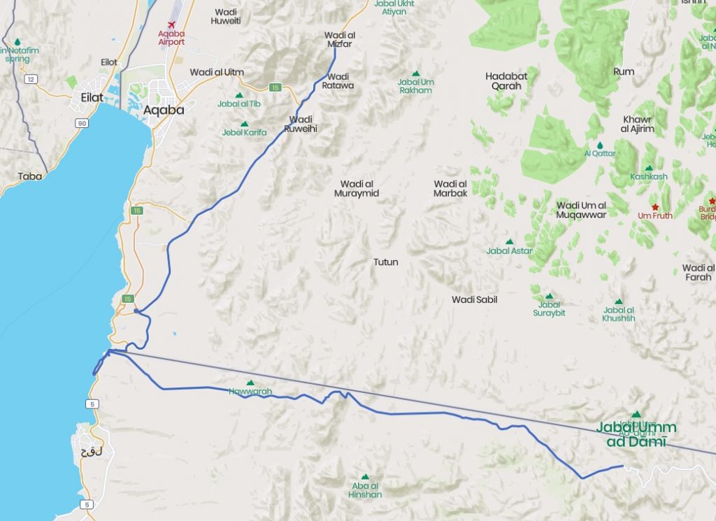
Take the road 16 miles south of Aqaba, hang a left (assuming you can get through the Saudi Arabian checkpoint), and follow the road about 37 miles. Google says it will take you about an hour and 26 minutes to get there.
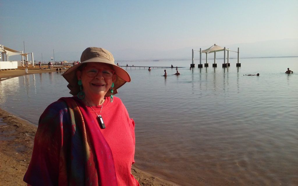
The lowest point in Jordan is, of course, the Dead Sea, at 1,412 feet below sea level. It is blue, rather than the gray I expected. We were struck by how beautiful it is, given that it is, well, dead.
Jordan can be divided into three main geographic and climatic areas: the Jordan Valley, the Mountain Heights Plateau, and the eastern desert, or Badia region.
Jordan Valley
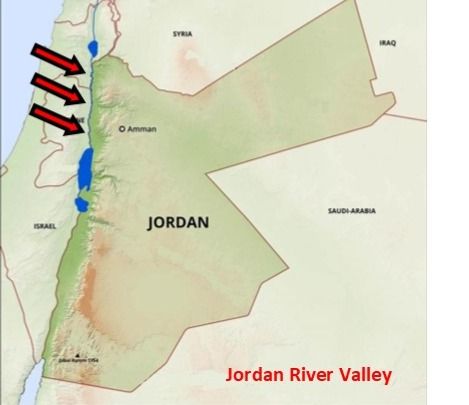
The Jordan Valley extends down the western side of the country. The northern segment (known in Arabic as the Ghor) is the most fertile part of the country. It is known as the food bowl of Jordan. It is several degrees warmer than the surrounding country, and the year-round climate, good soil, higher winter rainfall, and summer irrigation combine to give it that descriptive name.[4]
Some of the foods produced there are citrus, tomatoes, cucumbers, olives, strawberries, and stone fruits, along with sheep, poultry, and dairy.
Going to the souk and produce markets was something we greatly enjoyed during our trip to Aqaba.
Mountain Heights Plateau
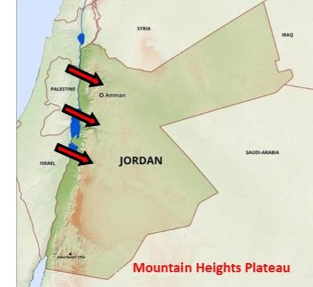
This part of the country separates the Jordan Valley from the eastern desert and is where most of the population lives. This is where most of the rain falls and the richest vegetation can be found.
It is here where Petra and other historical sites are located.
The agricultural land is 11.4% of the Jordanian landmass. That translates to:
- 2% Arable land
- 1% Permanent crops
- 8.4% Permanent pasture[5]
Northern Highlands
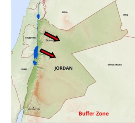
The northern part of the plateau, known as the Northern Highlands, extends southward to just north of Amman and is a typical Mediterranean climate. This is the Biblical Land of Gilead. It is higher and cooler than the southern areas. If you ever wondered where to get your balm, there it is.
Gilead
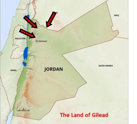
South and east of this area is a buffer zone against the desert. In ancient times, it was covered in a large area of flat unforested grassland, but it has turned into desert. South of this area is sparse rainfall and very scant vegetation.
Buffer Zone
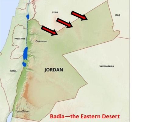
Badia – the Eastern Desert
This area makes up about 75% of Jordan. It spills into Syria, Iraq, and Saudi Arabia. The climate varies by day or night, summer and winter. August daytime temperatures are in the 105° F. range (sounds like Oklahoma), while winter nights can be brutally cold and windy (Oklahoma again). Rainfall rarely exceeds two inches a year. (We get 42″ a year where I live.)
The Eastern Desert north of Amman boasts many vegetated wadis.
Azraq Oasis
The Azraq Oasis is where Lawrence of Arabia set up his headquarters. The Thomari Wildlife Reserve is in this area, although the natural springs stopped producing in 1992, which reduced the bird population.[6]
Basalt Desert and Volcanic Region
There are some volcanic formations in the northern Basalt Desert which extend into Syria and Saudi Arabia. The black basalt boulders are very evident here. Ancient inscriptions suggest wildlife and vegetation once filled this area.
Reweishid Desert
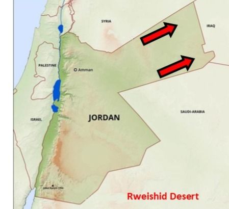
East of here is the Rweishid Desert, a limestone plateau extending to the Iraqi border. Amazingly, there is some grassland and agriculture.
Central Desert
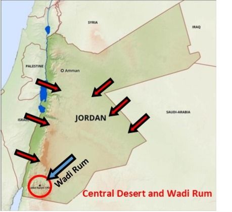
South of Amman is the area characterized by hills, low, rocky mountains, and broad wadis. In the southern end is the famous Wadi Rum. This landscape is unparalleled with towering sandstone mesas and backdrops coveted by movie producers. Twenty-six movies have been shot there to date. I will devote a future blog to this mysterious part of Jordan.
Dana Biosphere Reserve
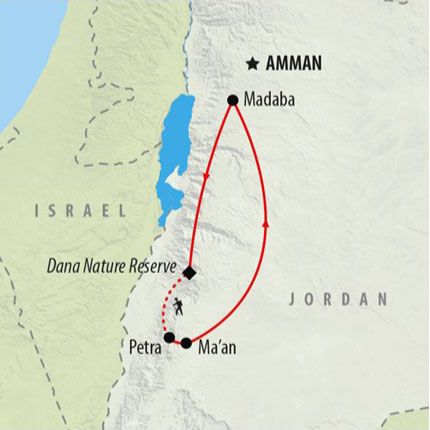
Tucked into the western mountain ridges and sweeping down from the 4,921 foot-high plateau, the Dana Biosphere Reserve is the largest in the country. It is comprised of 198 square miles. The mountains are cut by many steep-sided wadis, often lined with a lush growth of trees and shrubs. It is the only reserve in Jordan that includes the four different biogeographical zones of the country and is the most diverse in terms of habitats and species.[1]
Many folks put this stop on their agenda when visiting Jordan.
Natural Hazards
Everyone knows we have tornadoes in Oklahoma and in recent years, earthquakes as well. I’ve never heard of a tornado in Jordan, though. No hot and cold fronts booming against each other. Jordan is an earthquake-prone area, however. A 4.3 hit the Dead Sea in 2015, but no destructive quakes have happened since 1927.[2]
Droughts and flash floods are the other things to watch out for. In October 2018, a group of 21 Jordanian school children on a field trip near the Dead Sea drowned in a flash flood.[3]
Environmental Issues
There are five major issues:
- Limited natural fresh water resources (the main reason Jordan is financially suppressed)
- Deforestation
- Overgrazing
- Soil erosion
- Desertification
Natural Resources
Unlike its Arab cousins, Jordan is not blessed with petroleum, precious gems, coal, chromium, copper or other minerals. It must import all its gasoline. In December 2019, the average price per gallon at the pump is $5.39.[4]
What it does have for export are:
- Phosphates
- Potash
- Shale oil
Conclusion
I am merely dusting the surface of the diverse and fascinating subject of Jordan’s geography. For deeper insight into this captivating country, I invite you to do your own research.
Here is a clever six-minute video, which gives a LOT of information on Jordan, not just its geography. It is quick and entertaining. Enjoy!
This is the fifteenth in a series of 32 blogs we have planned so you can have a well-rounded view of the country and people of Jordan.
Several people have contacted us who feel the Lord may be calling them there. A year ago we made a three-week discovery trip to find out more about the place God is sending us. While our current blogs are very basic, once we move, we will provide more in-depth information.
We still advise taking a discovery trip if it is at all possible.
The next post will be about Jordan’s culture, hospitality, and friendliness.
[1] https://traveltips.usatoday.com/descriptions-major-landforms-jordan-104451.html Accessed 12/10/19
[2] https://en.wikipedia.org/wiki/Great_Rift_Valley Accessed 12/11/19
[3] https://www.cia.gov/library/publications/the-world-factbook/geos/jo.html Accessed 12/10/19
[4] https://www.kinghussein.gov.jo/geo_env1.html Accessed 12/11/19
[5] Ibid., CIA
[6] Ibid., Travel Tips
[7] https://www.rscn.org.jo/content/dana-biosphere-reserve-1 Accessed 12/11/19
[8] https://www.reuters.com/article/us-jordan-floods/jordan-flash-floods-kill-21-people-many-of-them-school-children-on-bus-idUSKCN1MZ2GI Accessed 12/11/19
[9] https://www.jordantimes.com/news/local/43-earthquake-hits-dead-sea-felt-amman-karak-and-madaba Accessed 12/11/19
[10] https://www.globalpetrolprices.com/Jordan/gasoline_prices/ Accessed 12/11/19